Nepal Floods: 939 Dead, Thousands Missing as Himalayan Glacial Collapse Unleashes Disaster
UNDP rapid assessment reveals 84,270 people affected, 2.2 million tonnes of debris, and USD 158.6 million in building damage across six districts
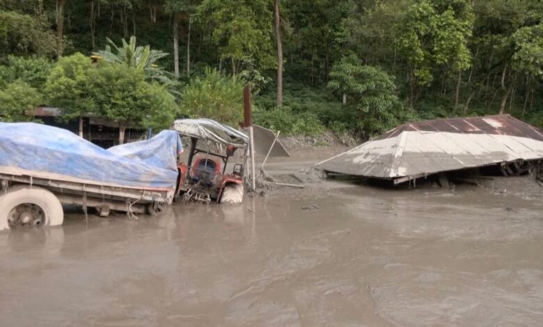
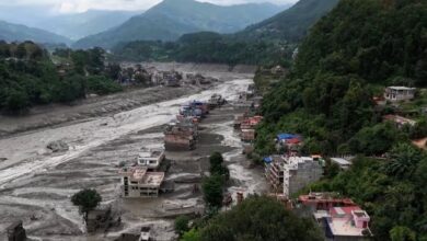
On August 26, 2026, disaster struck Nepal when a massive glacial collapse sent a devastating wall of water, mud, and debris rushing down the Trishuli River corridor. The flash flood tore through communities and infrastructure with little warning, leaving behind a trail of destruction that officials are still struggling to fully comprehend.
According to Nepal’s National Disaster Risk Reduction and Management Authority (NDRRMA), as of August 31, the confirmed death toll stands at 939 people – a number that continues to rise as rescue teams reach more affected areas. Hundreds remain missing, and approximately 3,925 people are still out of contact, including 644 foreign tourists who were in the region when the disaster struck.
A Crisis of Scale
The flood has affected 84,270 people across 17 municipalities in 6 districts: Rasuwa, Nuwakot, Dhading, Chitawan, Gorkha, and Tanahu.
The impact is heavily concentrated in just a few areas:
| Municipality | District | People Affected | % of Total |
|---|---|---|---|
| Bidur | Nuwakot | 25,354 | 30.1% |
| Benighat Rorang | Dhading | 11,313 | 13.4% |
| Gajuri | Dhading | 7,991 | 9.5% |
Together, these three municipalities account for nearly 53% of all affected people — over 44,600 individuals whose lives have been turned upside down.
Infrastructure in Ruins
The flood didn’t just affect people – it tore apart the very infrastructure that connects communities. Officials report:
- 80 bridges destroyed or severely damaged
- Approximately 42 kilometers (26 miles) of roads washed away
This destruction has made it extremely difficult for rescue teams to reach remote villages and deliver desperately needed food, water, and medical supplies.
Vulnerability Before the Flood
Perhaps most concerning is that the hardest-hit areas were already highly vulnerable before this disaster struck. According to the Multidimensional Vulnerability Index (MVI), which measures social and economic challenges using Nepal’s 2021 Census data:
- 76% of the affected population lives in municipalities that were already more vulnerable than the national average
- These are predominantly rural hill communities
- 67.4% of residents depend on agriculture for their livelihood (compared to 57% nationally)
- 15.9% of the population is aged 60 or older (compared to 12.5% nationally)
This means the communities swept by the flood were already struggling with poverty, limited access to services, and dependence on farming. Now, they have lost their crops, livestock, and productive land – which could make recovery especially difficult and slow.
Mountain of Debris
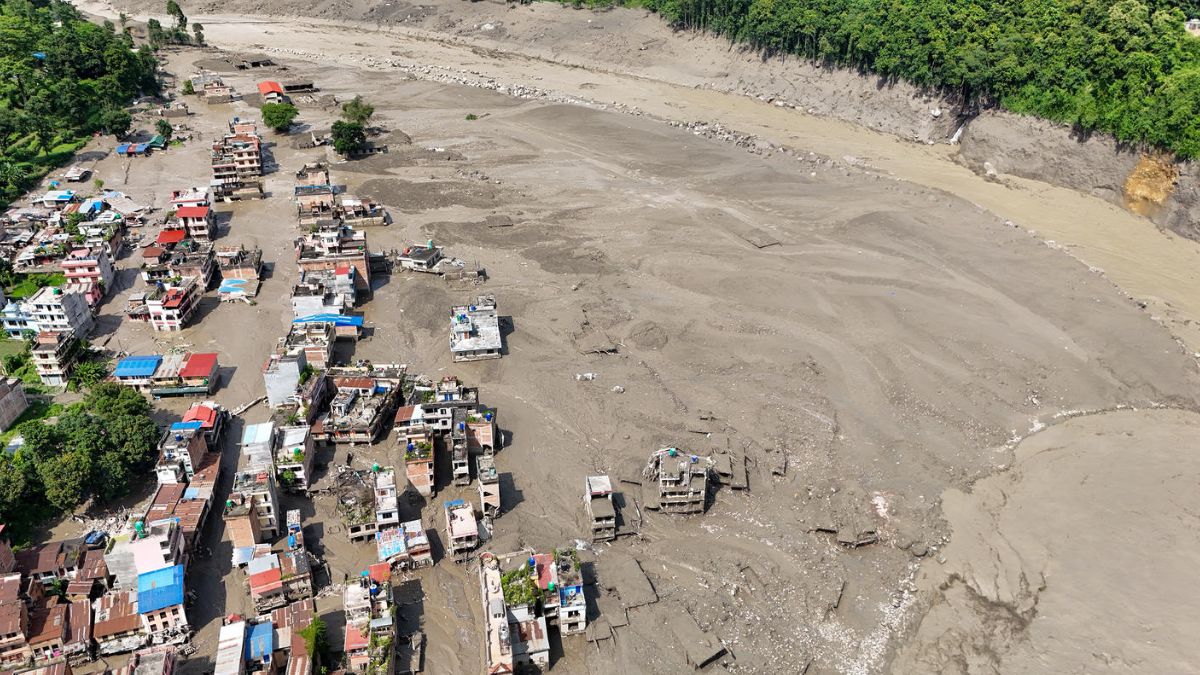
Satellite assessments have identified thousands of destroyed buildings. According to the rapid assessment:
- 2,359 buildings have been assessed
- 1,890 classified as destroyed
- 187 classified as damaged
- 282 classified as possibly damaged
The estimated building-related debris is 556,200 tonnes – enough to fill thousands of trucks. When including personal property, vegetation, and sediment mobilized by the floods, the total debris is estimated at a staggering 2.2 million tonnes.
Bidur alone accounts for approximately 456,400 tonnes of building debris – more than 80% of the total – reflecting the immense destruction in Nuwakot district.
Economic Devastation
The financial toll is enormous. Preliminary modelling estimates USD 158.6 million in potential building damage, with a range of USD 118.6 million to USD 220.3 million.
However, this only covers direct damage to residential and commercial buildings. It does not include:
- Roads, bridges, or other infrastructure (the government has separately estimated these at USD 1.3 billion)
- Agricultural losses
- Lost income and business interruption
- Displacement and humanitarian costs
- Reconstruction expenses
The true economic cost of this disaster will likely be much higher.
What Happens Next?
The RAPIDA (Rapid Assessment and Analysis for Immediate Recovery and Development Action) report, prepared by the United Nations Development Programme (UNDP), emphasizes that these are preliminary estimates meant to guide early decision-making. They stress that:
“These are preliminary modelled estimates intended to support early decision-making and prioritization. They do not represent confirmed damage, displacement or service disruption and should be validated through field assessments.”
The assessment relies on satellite data, damage classifications from Copernicus Emergency Management Service and SERTIT, and global modelling tools. On-the-ground verification with local authorities will be essential to get a complete picture of the destruction.