Deploying satellite data to detect waste dumping sites
Around 20% of the waste sites detected are found within a range of 200m from waterways.
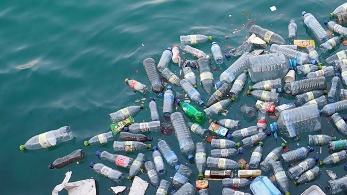
Huge piles of waste dumped by the roadside, in the forests, or at non-designated sites has become a common feature of most of the cities and villages alike around the world. They hinder the objective of keeping the environment clean and can have serious impacts on wildlife and habitat.
This trend is on the rise and illegal dumping is increasingly becoming a problem. Millions of metric tons of plastic waste enter oceans too every year, harming hundreds of species and their ecosystems. Better understanding about waste disposal is the need of the hour, but monitoring waste dumping still remains a difficult task.
Ray of hope in waste management
A team of researchers has come up with a process using satellites as a solution, a ray of hope indeed. They developed a new system of neural networks which can analyse satellite data for detecting waste sites on land. Using the new computational system, Caleb Kruse of Earthrise Media in Berkeley, California, Dr Fabien Laurier from the Minderoo Foundation in Washington DC analysed the data from the European Space Agency’s Sentinel-2 satellites with positive results.
The researchers first applied the new system in Indonesia in order to evaluate it. Later, on applying the process across South East Asia, they could identify 966 waste dumping sites. The research findings were published in the journal Plos One recently.


Around 20 per cent of the waste sites detected are found within a range of 200m from waterways. Some of these sites are seen spreading into rivers and eventually reach the ocean. The data from the study which is publicly available so that the stakeholders can use it to create awareness in their communities.
Remote-sensing survey soon
In another similar program, observations from a Nasa satellite will be used by non-profit group Carbon Mapper to discover the landfill sites responsible for emitting the potent greenhouse gas Methane in large quantities. The Earth Surface Mineral Dust Source Investigation (EMIT) and other Nasa science instruments will take part in this global survey.
The initial remote-sensing survey will be conducted in 2023 on more than 1,000 managed landfills across the US and Canada, and in key locations in Latin America, Africa, and Asia.