Geopolitics, lawlessness & security challenges affecting Indo-Myanmar border – Part I
Porous zones may be found along many artificially built borders, encouraging cross-border illicit activity. The Indo-Myanmar border is the clearest example of this.
After the military coup in Myanmar at the beginning of 2021, the refugees entering India from the neighbouring country suddenly saw a steep rise.
Witnessing the hordes of refugees entering the country, the Central government decided to seal off the Indo-Myanmar border. Whether the decision was right or wrong is altogether a different topic of discussion.
However, there has been consistent coverage of the border issues in news media since the refugee crises hit the nation and the reservations of the local population against the proposed fencing of the border.
International borders are more than artificial demarcating lines
International orders are not mere artificial lines demarcating two different national-territorial nations but are the outcome of evolving socio-political negotiations. Besides, these also represent national identities.

The barriers created by the borders are not only physical but also demarcate and impact the economy, society, culture and families of the two countries.
Most of the borderlands in Asia are marginal, isolated and remote borders like the India-Pakistan border, the India-China border or the most neglected Indo-Myanmar boundary.
Artificially-created borders lead to border disputes
The South Asian borders can be distinguished by two specific features including topographic diversity and arbitrary delineation by colonial powers.
While the Indo-Sino border is an example of topographic borders, the border between India and Pakistan was artificially delineated by the Britishers. It is the result of these artificially created borders that the border disputes mar the relations among most of the South-Asian countries.
Numerous areas of artificially-created borders are also porous areas facilitating cross border illegal activities and the Indo-Myanmar border is the best example in this connection.
Strategic geographical dimensions of Indo-Myanmar border
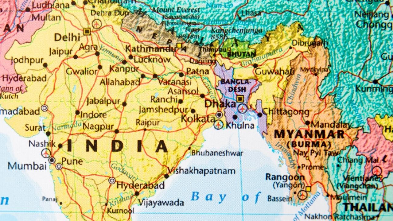
North-eastern states account for nearly 8% of India’s land area and share 5400 kilometres border with neighbouring countries like Bhutan, China, Myanmar, Bangladesh and Nepal.
Connected to Mainland India through the ‘Siliguri Corridor (Chicken Neck)’, only two per cent (2%) of this region’s border area constitutes India’s national border and the rest constitutes international border with land leakages with Nepal, Bhutan, China, Bangladesh and Myanmar.
Given the borderlands closeness with multiple countries, this region has always been strategically important, with the Indo-Myanmar borderline being the most complex issue.